Revisão de métodos de mapeamento de microclimas no ambiente florestal
Resumo
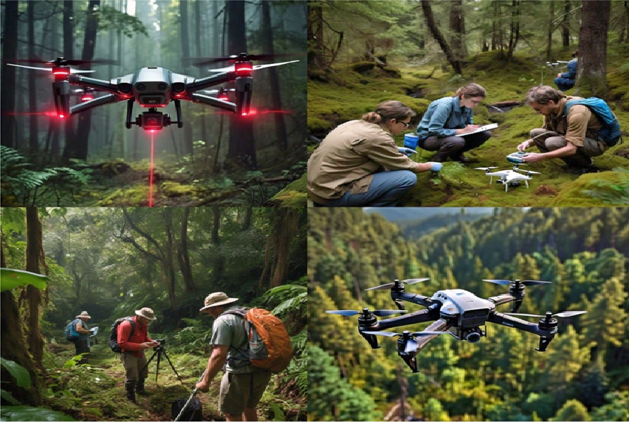
O estudo dos microclimas apresenta uma série de benefícios que implicam em sua importância na redução dos efeitos das mudanças climáticas, de modo que o mapeamento destes surge como uma alternativa para sua identificação e conservação. O objetivo desta revisão é identificar as técnicas utilizadas no mapeamento de microclimas. A metodologia utilizada foi uma revisão exploratória em bases de dados como Science Direct, Springer e IEEXplore, determinando que existe uma escassez de artigos relacionados com o mapeamento de microclimas, uma vez que apenas 19 artigos cumpriram os requisitos de inclusão para revisão. O foco principal do mapeamento microclimático foi identificado como sendo o mapeamento da copa das árvores, da altura e da densidade das estruturas florestais e seus efeitos sobre os fatores climáticos constituintes. Por outro lado, os métodos de mapeamento microclimático identificados foram divididos em métodos fotogramétricos e métodos de varredura a laser, sendo que a maioria dos estudos se baseou na coleta de dados aéreos, seja por drones (UAV, UAS, RPA, RPAS) ou aeronaves, como no caso das tecnologias LiDAR aéreas. Concluiu-se que há pouca pesquisa sobre mapeamento de microclima, portanto, a comunidade científica florestal é incentivada a usar as várias metodologias para objetivos de grande impacto sobre o meio ambiente, como a previsão de incêndios florestais e o monitoramento da restauração florestal após esses incêndios.
Downloads
Referências
Brüllhardt, M., Rotach, P., Schleppi, P., & Bugmann, H. (2020). Vertical light transmission profiles in structured mixed deciduous forest canopies assessed by UAV-based hemispherical photography and photogrammetric vegetation height models. Agricultural and Forest Meteorology, 281, 107843. https://doi.org/10.1016/J.AGRFORMET.2019.107843
Camarretta, N., Harrison, P. A., Bailey, T., Potts, B., Lucieer, A., Davidson, N., & Hunt, M. (2019). Monitoring forest structure to guide adaptive management of forest restoration: a review of remote sensing approaches. New Forests, 51(4), 573–596. https://doi.org/10.1007/S11056-019-09754-5
Carnicer, J., Vives-Ingla, M., Blanquer, L., Méndez-Camps, X., Rosell, C., Sabaté, S., Gutiérrez, E., Sauras, T., Peñuelas, J., & Barbeta, A. (2021). Forest resilience to global warming is strongly modulated by local-scale topographic, microclimatic and biotic conditions. Journal of Ecology, 109(9), 3322–3339. https://doi.org/10.1111/1365-2745.13752
Chung, C. H., & Huang, C. Y. (2020). Hindcasting tree heights in tropical forests using time-series unmanned aerial vehicle imagery. Agricultural and Forest Meteorology, 290, 108029. https://doi.org/10.1016/J.AGRFORMET.2020.108029
Colica, E., D’Amico, S., Lannucci, R., Martino, S., Gauci, A., Galone, L., Galea, P., & Paciello, A. (2021). Using unmanned aerial vehicle photogrammetry for digital geological surveys: case study of Selmun promontory, northern of Malta. Environmental Earth Sciences, 80(17), 1–14. https://doi.org/10.1007/S12665-021-09846-6/TABLES/3
De Frenne, P., Michel, J. R., Lenoir, H., Luoto, M., Scheffers, B., Zellweger, F., Aalto, J., Ashcroft, M., Christiansen, D., Decocq, G., De Pauw, K., & Zell-Weger, F. (2021). Forest microclimates and climate change: Importance, drivers and future research agenda. Global Change Biology, 27(11), 2279-2297. https://doi.org/10.1111/gcb.15569
Di Stefano, F., Chiappini, S., Gorreja, A., Balestra, M., & Pierdicca, R. (2021). Mobile 3D scan LiDAR: a literature review. Geomatics, Natural Hazards and Risk, 12(1), 2387–2429. https://doi.org/10.1080/19475705.2021.1964617
Duffy, J. P., Anderson, K., Fawcett, D., Curtis, R. J., & Maclean, I. M. D. (2021). Drones provide spatial and volumetric data to deliver new insights into microclimate modelling. Landscape Ecology, 36(3), 685–702. https://doi.org/10.1007/S10980-020-01180-9
Elkhrachy, I. (2021). Accuracy Assessment of Low-Cost Unmanned Aerial Vehicle (UAV) Photogrammetry. Alexandria Engineering Journal, 60(6), 5579–5590. https://doi.org/10.1016/J.AEJ.2021.04.011
Fernandez-Manso, A., Quintano, C., & Roberts, D. A. (2019). Burn severity analysis in Mediterranean forests using maximum entropy model trained with EO-1 Hyperion and LiDAR data. ISPRS Journal of Photogrammetry and Remote Sensing, 155, 102–118. https://doi.org/10.1016/J.ISPRSJPRS.2019.07.003
Ferrari, R., Lachs, L., Pygas, D. R., Humanes, A., Sommer, B., Figueira, W. F., Edwards, A. J., Bythell, J. C., & Guest, J. R. (2021). Photogrammetry as a tool to improve ecosystem restoration. Trends in Ecology and Evolution, 36(12), 1093–1101. https://doi.org/10.1016/J.TREE.2021.07.004
Glasmann, F., Senf, C., Seidl, R., & Annighöfer, P. (2023). Mapping subcanopy light regimes in temperate mountain forests from Airborne Laser Scanning, Sentinel-1 and Sentinel-2. Science of Remote Sensing, 8, 100107. https://doi.org/10.1016/J.SRS.2023.100107
Gril, E., Laslier, M., Gallet-Moron, E., Durrieu, S., Spicher, F., Le Roux, V., Brasseur, B., Haesen, S., Van Meerbeek, K., Decocq, G., Marrec, R., & Lenoir, J. (2023). Using airborne LiDAR to map forest microclimate temperature buffering or amplification. Remote Sensing of Environment, 298, 113820. https://doi.org/10.1016/J.RSE.2023.113820
Gruen, A. (2021). Everything moves: The rapid changes in photogrammetry and remote sensing. Geo-Spatial Information Science, 24(1), 33–49. https://doi.org/10.1080/10095020.2020.1868275
Hu, Q., Zhang, L., Drahota, J., Woldt, W., Varner, D., Bishop, A., LaGrange, T., Neale, C. M. U., & Tang, Z. (2024). Combining Multi-View UAV Photogrammetry, Thermal Imaging, and Computer Vision Can Derive Cost-Effective Ecological Indicators for Habitat Assessment. Remote Sensing, 16(6), 1081. https://doi.org/10.3390/RS16061081/S1
Jiménez-Jiménez, S. I., Ojeda-Bustamante, W., Marcial-Pablo, M. D. J., & Enciso, J. (2021). Digital Terrain Models Generated with Low-Cost UAV Photogrammetry: Methodology and Accuracy. ISPRS International Journal of Geo-Information, 10(5), 285. https://doi.org/10.3390/IJGI10050285
Kangas, A., Gobakken, T., Puliti, S., Hauglin, M., & Næsset, E. (2018). Value of airborne laser scanning and digital aerial photogrammetry data in forest decision making. Silva Fennica, 52(1), 19. https://doi.org/10.14214/SF.9923
Kašpar, V., Hederová, L., Macek, M., Müllerová, J., Prošek, J., Surový, P., Wild, J., & Kopecký, M. (2021). Temperature buffering in temperate forests: Comparing microclimate models based on ground measurements with active and passive remote sensing. Remote Sensing of Environment, 263, 112522. https://doi.org/10.1016/J.RSE.2021.112522
Kissling, W. D., Shi, Y., Koma, Z., Meijer, C., Ku, O., Nattino, F., Seijmonsbergen, A. C., & Grootes, M. W. (2022). Laserfarm – A high-throughput workflow for generating geospatial data products of ecosystem structure from airborne laser scanning point clouds. Ecological Informatics, 72, 101836. https://doi.org/10.1016/J.ECOINF.2022.101836
Kovanič, Ľ., Topitzer, B., Peťovský, P., Blišťan, P., Gergeľová, M. B., & Blišťanová, M. (2023). Review of Photogrammetric and Lidar Applications of UAV. Applied Sciences, 13(11), 6732. https://doi.org/10.3390/APP13116732
Kudela, P., Palcak, M., Zabovska, K., & Bucko, B. (2020). Integration of photogrammetry within laser scanning approach. 2020 43rd International Convention on Information, Communication and Electronic Technology, MIPRO, 1691–1694. https://doi.org/10.23919/MIPRO48935.2020.9245297
Lin, Y., Filin, S., Billen, R., & Mizoue, N. (2023). Co-developing an international TLS network for the 3D ecological understanding of global trees: System architecture, remote sensing models, and functional prospects. Environmental Science and Ecotechnology, 16, 100257. https://doi.org/10.1016/J.ESE.2023.100257
Mislan, K. A. S., & Helmuth, B. (2008). Microclimate. Encyclopedia of Ecology, 5, 389–2393. https://doi.org/10.1016/B978-008045405-4.00520-6
Moon, D., Chung, S., Kwon, S., Seo, J., & Shin, J. (2019). Comparison and utilization of point cloud generated from photogrammetry and laser scanning: 3D world model for smart heavy equipment planning. Automation in Construction, 98, 322–331. https://doi.org/10.1016/J.AUTCON.2018.07.020
Nakamura, A., Kitching, R. L., Cao, M., Creedy, T. J., Fayle, T. M., Freiberg, M., Hewitt, C. N., Itioka, T., Koh, L. P., Ma, K., Malhi, Y., Mitchell, A., Novotny, V., Ozanne, C. M. P., Song, L., Wang, H., & Ashton, L. A. (2017). Forests and Their Canopies: Achievements and Horizons in Canopy Science. Trends in Ecology and Evolution, 32(6), 438–451. https://doi.org/10.1016/J.TREE.2017.02.020
Nitoslawski, S. A., Wong-Stevens, K., Steenberg, J. W. N., Witherspoon, K., Nesbitt, L., & Konijnendijk van den Bosch, C. C. (2021). The Digital Forest: Mapping a Decade of Knowledge on Technological Applications for Forest Ecosystems. Earth’s Future, 9(8). https://doi.org/10.1029/2021EF002123
Nuijten, R. J. G., Coops, N. C., Theberge, D., & Prescott, C. E. (2023). Estimation of fine-scale vegetation distribution information from RPAS-generated imagery and structure to aid restoration monitoring. Science of Remote Sensing, 9, 100114. https://doi.org/10.1016/J.SRS.2023.100114
Parent, J. R., & Volin, J. C. (2014). Assessing the potential for leaf-off LiDAR data to model canopy closure in temperate deciduous forests. ISPRS Journal of Photogrammetry and Remote Sensing, 95, 134–145. https://doi.org/10.1016/J.ISPRSJPRS.2014.06.009
Pérez-Cabello, F., Montorio, R., & Alves, D. B. (2021). Remote sensing techniques to assess post-fire vegetation recovery. Current Opinion in Environmental Science and Health, 21, 100251. https://doi.org/10.1016/J.COESH.2021.100251
Puliti, S., Dash, J. P., Watt, M. S., Breidenbach, J., & Pearse, G. D. (2020). A comparison of UAV laser scanning, photogrammetry and airborne laser scanning for precision inventory of small-forest properties. Forestry: An International Journal of Forest Research, 93(1), 150–162. https://doi.org/10.1093/FORESTRY/CPZ057
Qi, Y., Coops, N. C., Daniels, L. D., & Butson, C. R. (2022). Comparing tree attributes derived from quantitative structure models based on drone and mobile laser scanning point clouds across varying canopy cover conditions. ISPRS Journal of Photogrammetry and Remote Sensing, 192, 49–65. https://doi.org/10.1016/J.ISPRSJPRS.2022.07.021
Qubaa, A. R., Thannoun, R. G., & Mohammed, R. M. (2022). UAVs/drones for photogrammetry and remote sensing: Nineveh archaeological region as a case study. World Journal of Advanced Research and Reviews, 14(3), 358–368. https://doi.org/10.30574/WJARR.2022.14.3.0539
Smith-Tripp, S. M., Eskelson, B. N. I., Coops, N. C., & Schwartz, N. B. (2022). Canopy height impacts on the growing season and monthly microclimate in a burned forest of British Columbia, Canada. Agricultural and Forest Meteorology, 323, 109067. https://doi.org/10.1016/J.AGRFORMET.2022.109067
Ulrey, C., Quintana-Ascencio, P. F., Kauffman, G., Smith, A. B., & Menges, E. S. (2016). Life at the top: Long-term demography, microclimatic refugia, and responses to climate change for a high-elevation southern Appalachian endemic plant. Biological Conservation, 200, 80-92. https://doi.org/10.1016/j.biocon.2016.05.028
Villani, L., Castelli, G., Sambalino, F., Almeida Oliveira, L. A., & Bresci, E. (2021). Influence of trees on landscape temperature in semi-arid agro-ecosystems of East Africa. Biosystems Engineering, 212, 185–199. https://doi.org/10.1016/J.BIOSYSTEMSENG.2021.10.007
Yépez-Rincón, F. D., Luna-Mendoza, L., Ramírez-Serrato, N. L., Hinojosa-Corona, A,. & Ferriño-Fierro, A. L. (2021). Assessing vertical structure of an endemic forest in succession using terrestrial laser scanning (TLS). Case study: Guadalupe Island. Remote Sensing of Environment, 263, 112563. https://doi.org/10.1016/J.RSE.2021.112563
Zellweger, F., De Frenne, P., Lenoir, J., Rocchini, D., & Coomes, D. (2019). Advances in Microclimate Ecology Arising from Remote Sensing. Trends in Ecology and Evolution, 34(4), 327–341. https://doi.org/10.1016/J.TREE.2018.12.012

Direitos de Autor (c) 2024 Manuel Sánchez-Chero, José Antonio Sánchez-Chero, Lesly Carolina Flores-Mendoza, Felix Navarro Janampa, Devyn Omar Donayre Hernández, Mary Flor Cesare Coral

This work is licensed under a Creative Commons Attribution-NonCommercial-ShareAlike 4.0 International License.


